Late July 2024
Week1&2 Adelaide’s winter this year seems to be one of frigid polar winds and endless grey skies. It’s true that Spring is only a few weeks away, but I reckon our bush team could sneak in a short trip up North to Central Australia and in particular the many majestic gorges and canyons that are within striking distance of Alice Springs. One of my travelling companions has only two weeks to spare so we need to get to The Alice quickly and arrange a flight for her at the end of that time whilst I and my sister party on.
So, it’s a before dawn start with the goal of reaching Coober Pedy some 900kms away by dusk. Night time travel in these zones is not wise because of all the stray wildlife (read Kangaroos, Emus and cattle) that the roads after dark. This is a significant enough problem that even heavy transports tend to pull over during these hours to prevent the inevitable damage to their vehicles.
We reach Coober Pedy, the largest source of opals in the world well before dusk and head off the next day for The Alice. We will spend a couple of nights there to provision for our 9 days in a bush camp on the Western edge of the MacDonnell ranges. As expected, we were assaulted with below zero nights, but at least the days warmed nicely after the initial chill. Just to get the walking legs into gear we nipped out to Simpsons Gap to walk the Woodland Trail.
The next day its onto Redbank Gorge where we know we will be camping without vans or many other folks around us. The only amenity here is a pit loo and that’s broken. Food, water, wood and everything else we need have to be brought in for the period of our planned stay. We know from experience that not many people camp for more than a night or two in this area, and certainly those monstrous vans just don’t work here because it’s designed for basic camping only. Folk who pop in, and who are willing to suffer the privations are here for the Mt Sonder ascent, being the end of the famous and wonderful Larapinta trail. Having walked this trail and climbed Mt Sonder many times in the past we will use our precious time for other explorations.
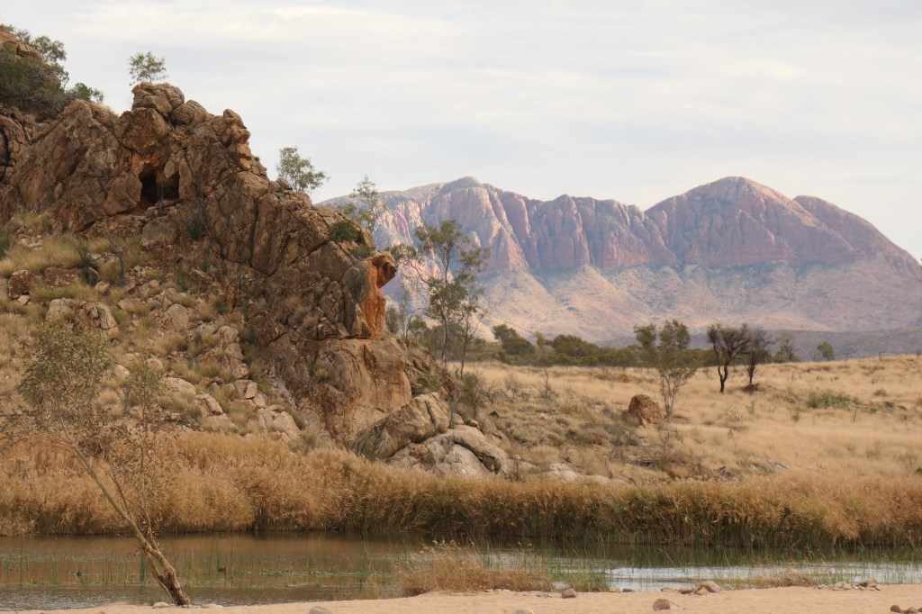
I must say that Mt Sonder is my favourite in the Western MacDonnells. It’s the type of landmark that imposes itself upon you as you walk steadily towards it in the latter days of the Larapinta trail from Alice Springs some 230kms to the East.
But here we are at Redbank Gorge with lots of wood collected and ready for a few nights. Head lamps are close by, camp is organised and its time to start tea. Now should you think its snags, chops and hamburgers I must say our radar is more attuned to meals such as tacos, spicey pork sweet and sour, chicken green curry, lime infused chicken strips, thinly sliced pepper steak, fried rice and spaghetti bolognese; all cooked over the fire or on a gas burner with a Wok. Meat is cryopacked and fresh salad, veges, rice or noodles accompany our meals. Yum! Judy’s Roti is also a hit as an add on element, whilst dampers supply the bread substitute.
Apart from chatting over the fire we will pass the nights listening to or reading preloaded books or podcasts on our devices. Remembering of course that over so many days out in the “donga” recharging these tools will be a challenge.
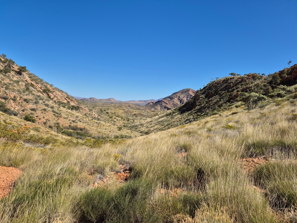
So we are now set up and looking forward to some action. Judy and I planned to do some cross country walks this year, but the grass is so high and dense that its either walk the creek beds or potentially step on the snakes that will be hanging around. Normally its easy to avoid these fellows but this year the vegetation is lush around the rivers and creeks. Never mind we want to head down the middle of the Finke river to the Glen Helen trail head on the Larapinta trail.
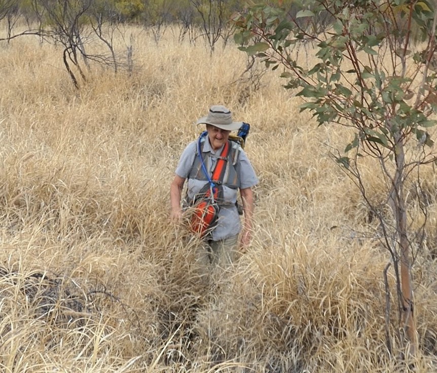
Confessions here …going a little off course we do end up ploughing through waist deep grass for a while, hoping that we are making enough noise to ensure our slithery mates head in the opposite direction. Thankfully no nips or heads raised in attack mode.
Reaching the trail head it’s time for nibbles and then to find a route across the river to enable us to head back towards the Pacoota range and our vehicle. As you can see spinifex abounds and one needs to be careful to stay well clear of the razor-sharp barbs.
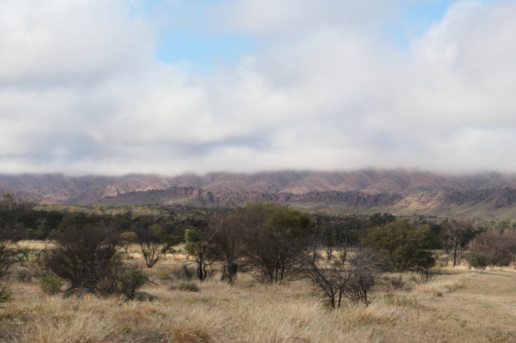
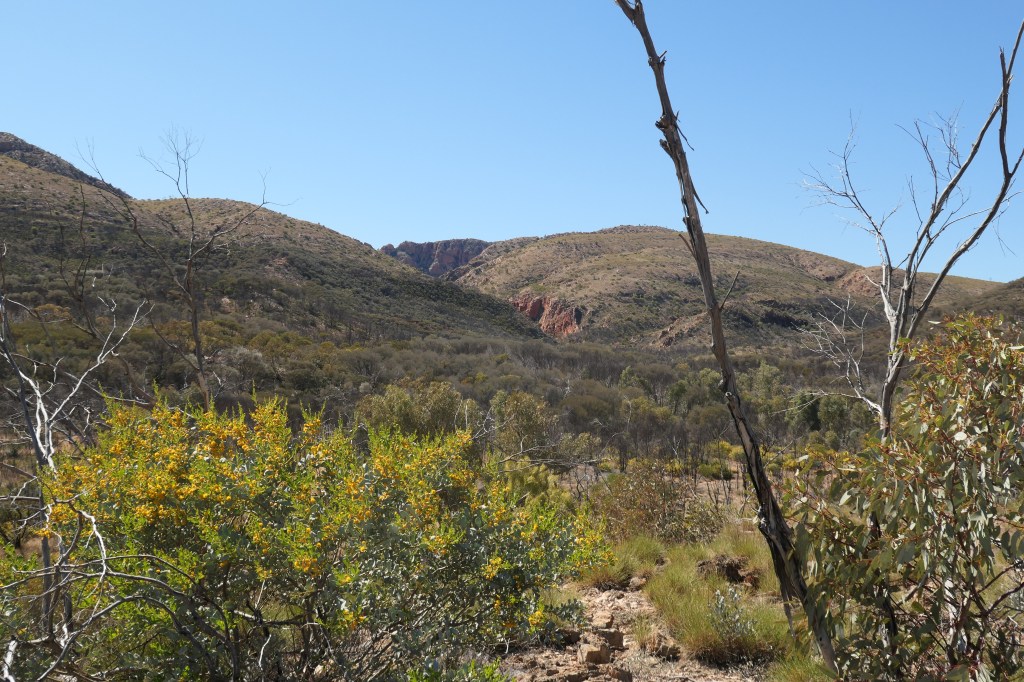
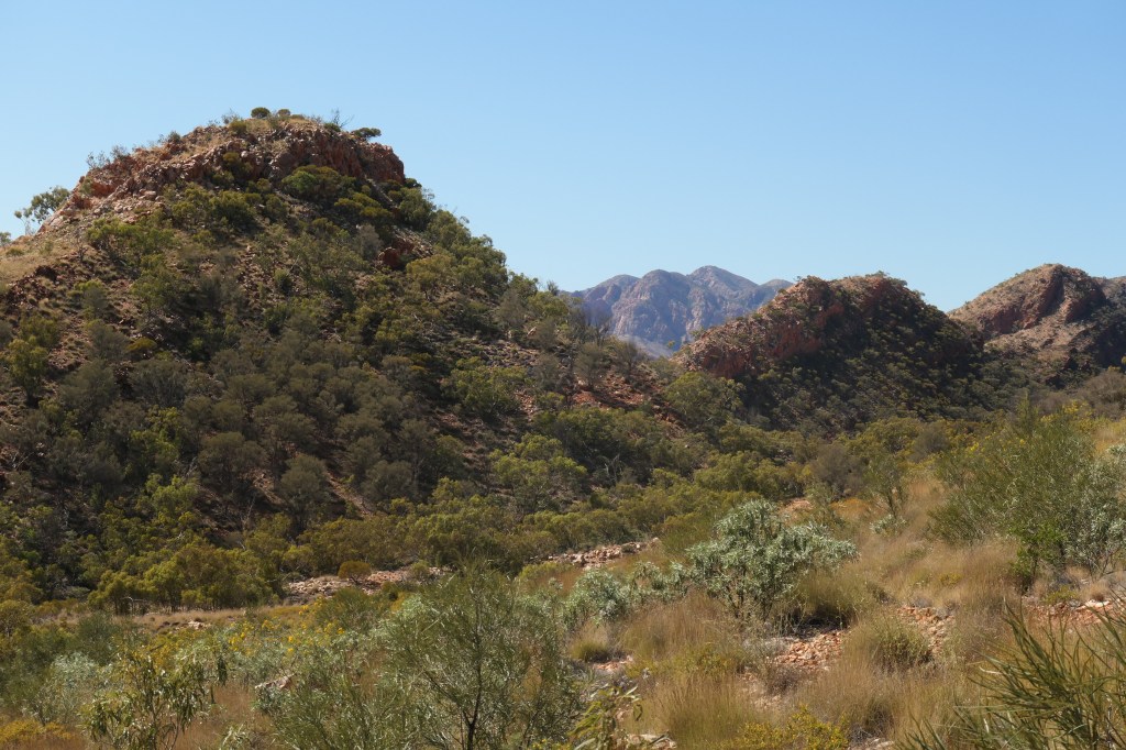
The next day dawns a little cloudy. We have chosen to join the Larapinta trail at the Serpentine Chalet dam, a feature of yesteryear, with a view to reaching the Inarlanga pass. Rather than head through the pass we will veer South towards to Ochre pits which have cultural significance for the local indigenous community. Driving to the take off zone we are greatly surprised to see clouds hanging over the Pacoota range; a feature I have never seen in all my time travelling these areas. Naturally the low clouds clear quickly as the sun rises, but it feels a little eerie.
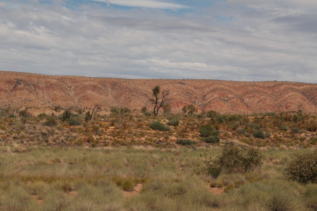
Walking from a rough vehicle track onto the Larapinta trail we enjoy the wide vistas of valleys and gorges, with the Inarlanga pass in the distance. It’s not our plan negotiate this pass as we did when walking the whole trail but to veer South towards the Ochre pits. With the pass behind us we must negotiate rough stoney shale for quite some time to eventually reach our goal. The beautiful views around the pass are made more splendid with masses of Wattle, Senna and wildflowers that are in full bloom.
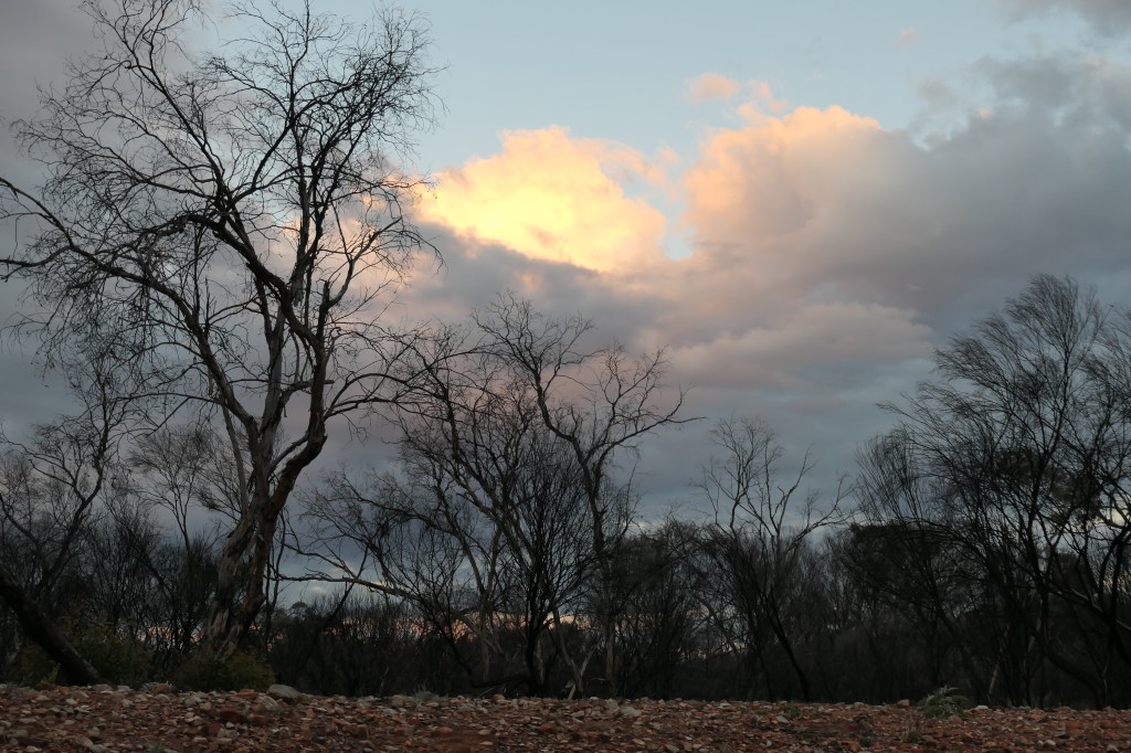
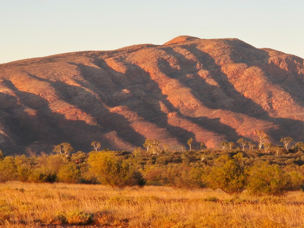
That night clouds return to provide a pretty sunset, off set by the trees burnt from recent fires. These will of course regrow in the next couple of years so all is not lost. The following night we do the traditional thing for us and head out away from camp to watch sunset on the mountains, in this case Mt Sonder.
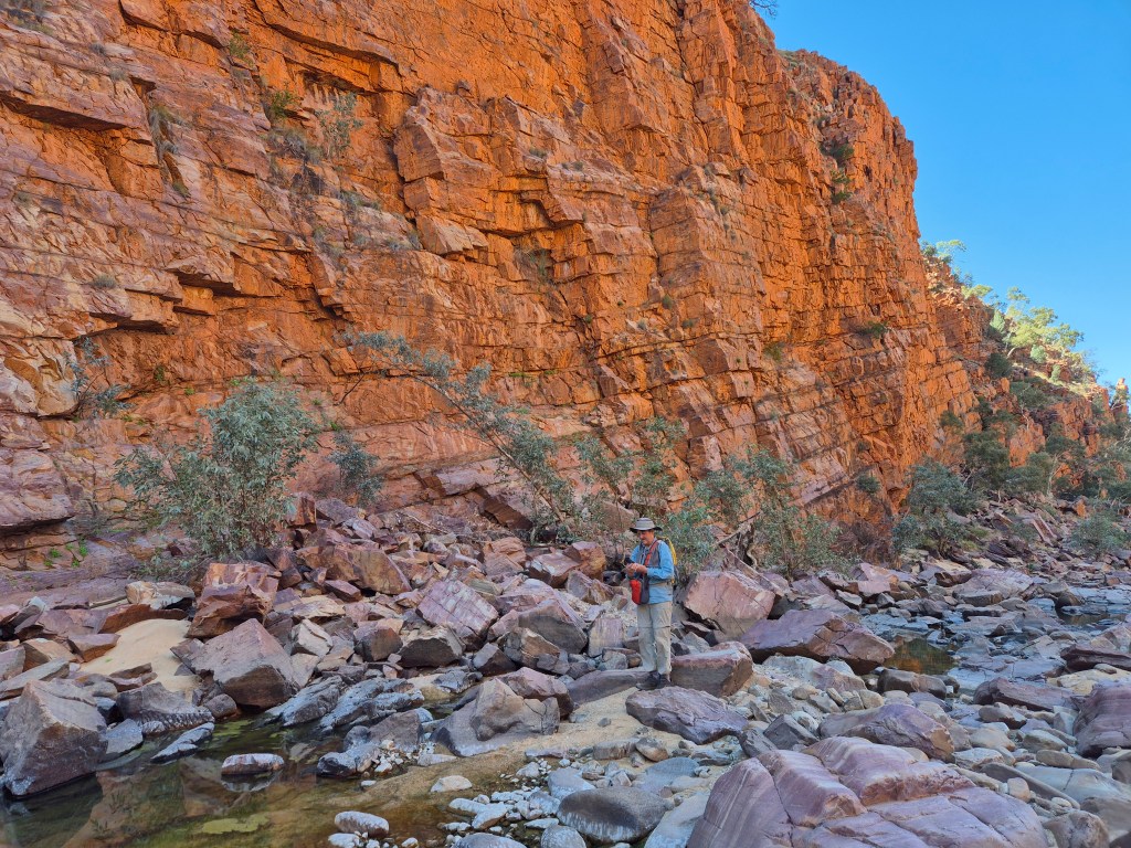
We decide on another walk up the Finke River for bird watching and photography. But Ormiston Gorge and Pound beckon so our packs need to be organised for tomorrow. This will be a long but amazingly scenic few hours. We start from the Ormiston Gorge café before walking along the Southern wall of the pound to enter it at the Eastern end later. Again, fresh and flowering Spinifex, wildflowers, Senna and Wattle colours the mountain sides yellow. The massive cliffs of the gorge taunt us (top L)as we climb away from them and up and down valleys to a high point. Here we glimpse parts of the pound we will enter later, as well as Mt Giles (bottom) in the very distance.

After some time we are walking into the pound and suddenly in the distance the Ormiston gorge beckons over in a Westerly direction. There is no mistaking these massive cliffs even from this distance away. The Heavitree range forms this pound.

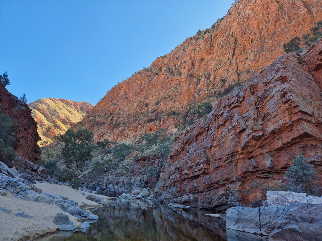
Walking past a collection of water that is clearly well visited by birds we gradually make our way over creek beds and rocks to the gorge itself.
Now the walking will be tougher as, at this point one must traverse a significant distance of big rocks. We know that we will have it largely to ourselves as few tourists bother to climb through the gorge to peer at the furthest cliffs or to see Mt Giles. Indeed, the whole walk has been a solitary one for us…nice. The rewards of our efforts are obvious!
After quite some time clambering up and over the rocks, to small islands of sand we eventually arrive back at the café and its time to spend some money on a rare coffee and shower…nice.
Well that was great fun, but tomorrow we need to transport one of the team into town to the airport and then my sister and I will travel on after reprovisioning.
Week 3
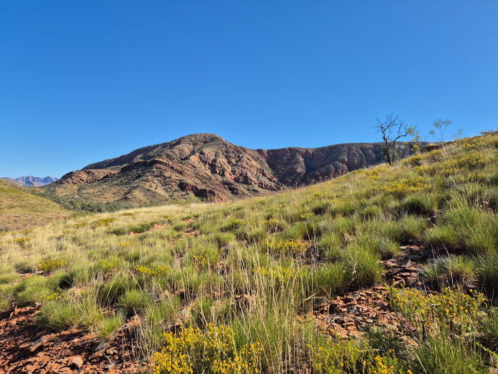
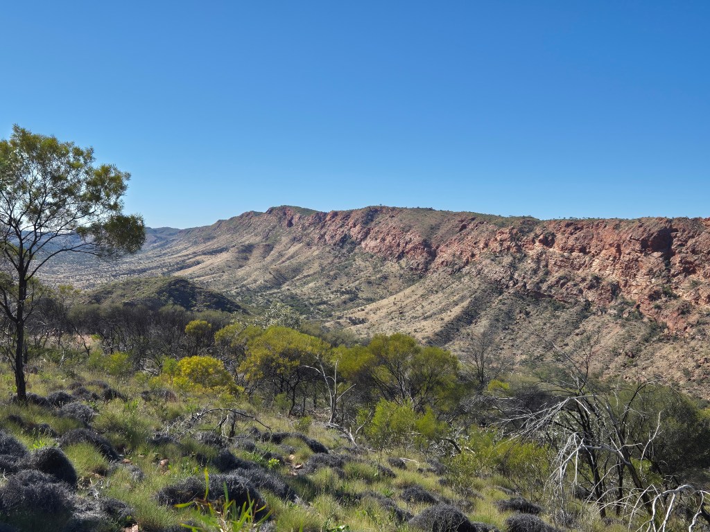
Our targets for this stage of the trip are the Eastern MacDonnells and Kings Canyon which is within cooee of Uluru and Katajuta. The Heavitree range to the East of Alice Springs is quite different to the West. The geology seems unique and I am of the view that its really picturesque. Setting up camp is quick and easy and then the next day it’s a walk down into the valley.
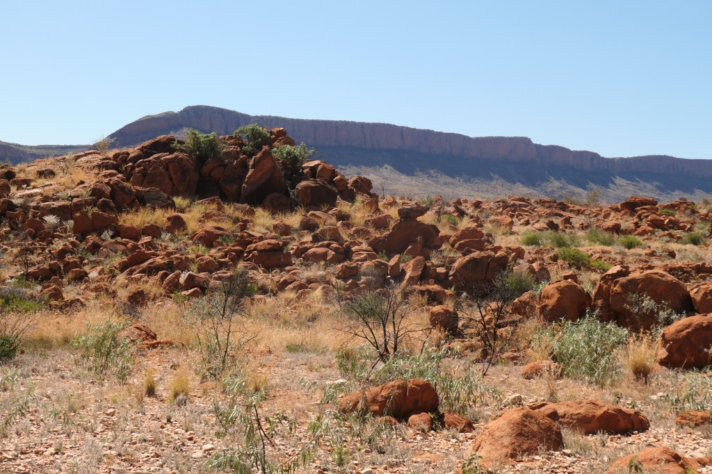
The next day its onto Trephina Gorge an old favourite. There are plenty of big rock formations around but I figure you need a rest from these until we get to the mighty Kings Canyon. Time to head that way.
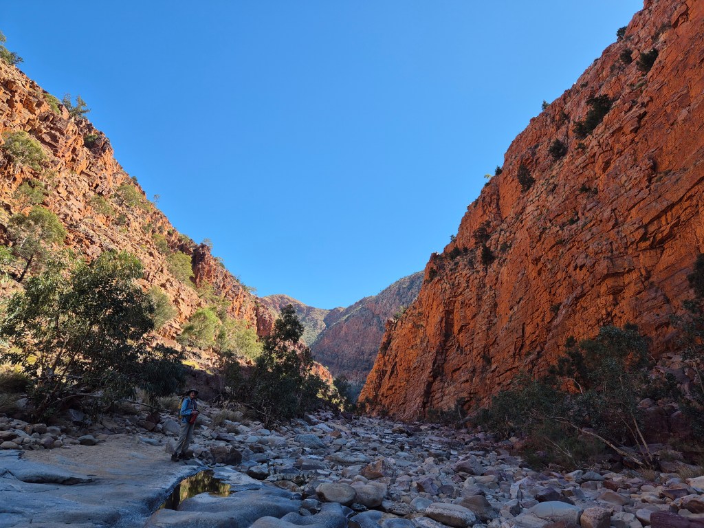
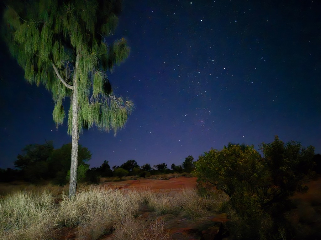
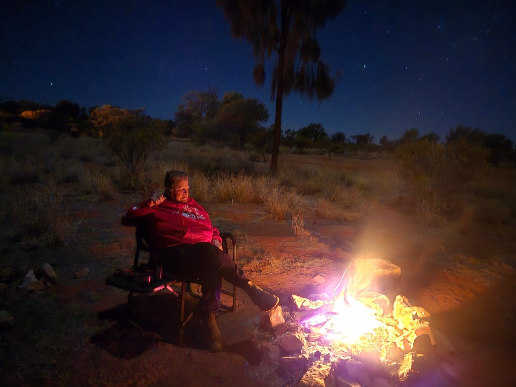
The nights are cool and very relaxing under the Southern Cross which I hope you can see in the L picture. There is a job to do here and that’s to climb up to the South Rim of the Canyon because one gets to see some of its glory there. Sadly, I don’t have time for the whole rim walk or you would have been drowned in pictures…this is restraint on my part.
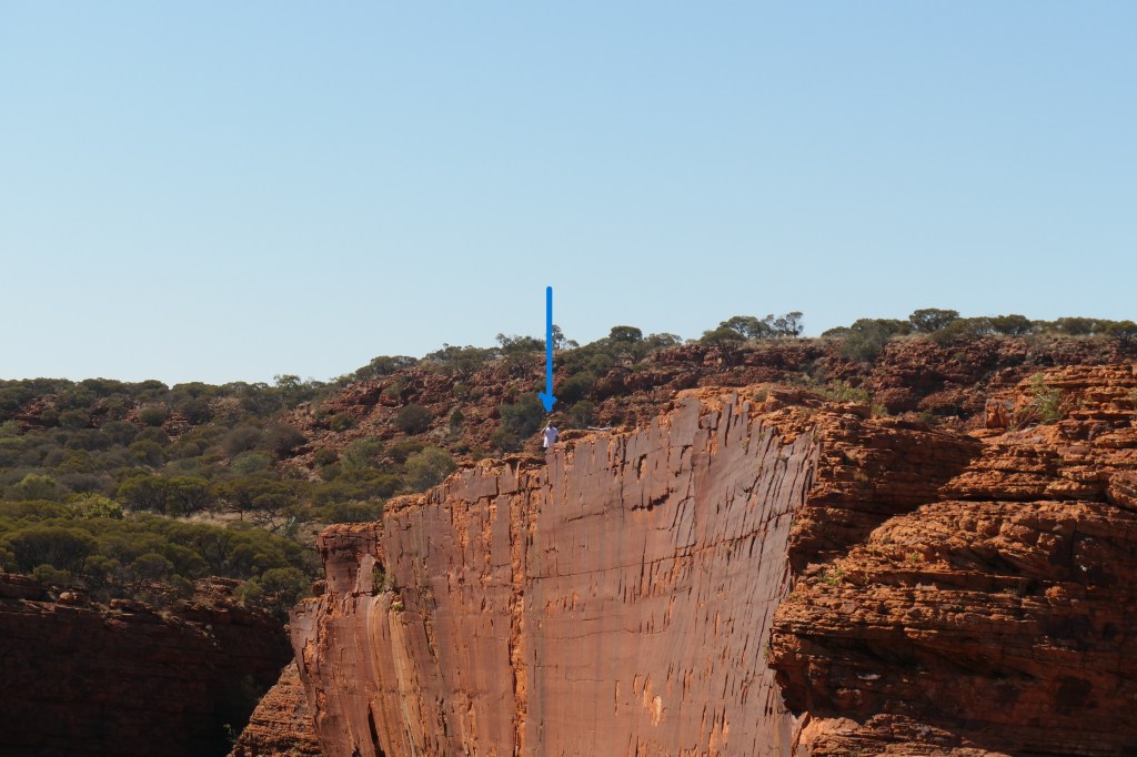
Now as you can see below the views are pretty good and to get it into perspective I took a picture of a person at the top of the cliff…yes that blue dot on the picture below this one. Personally I would not be standing that close…but there you are.
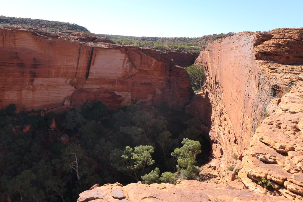
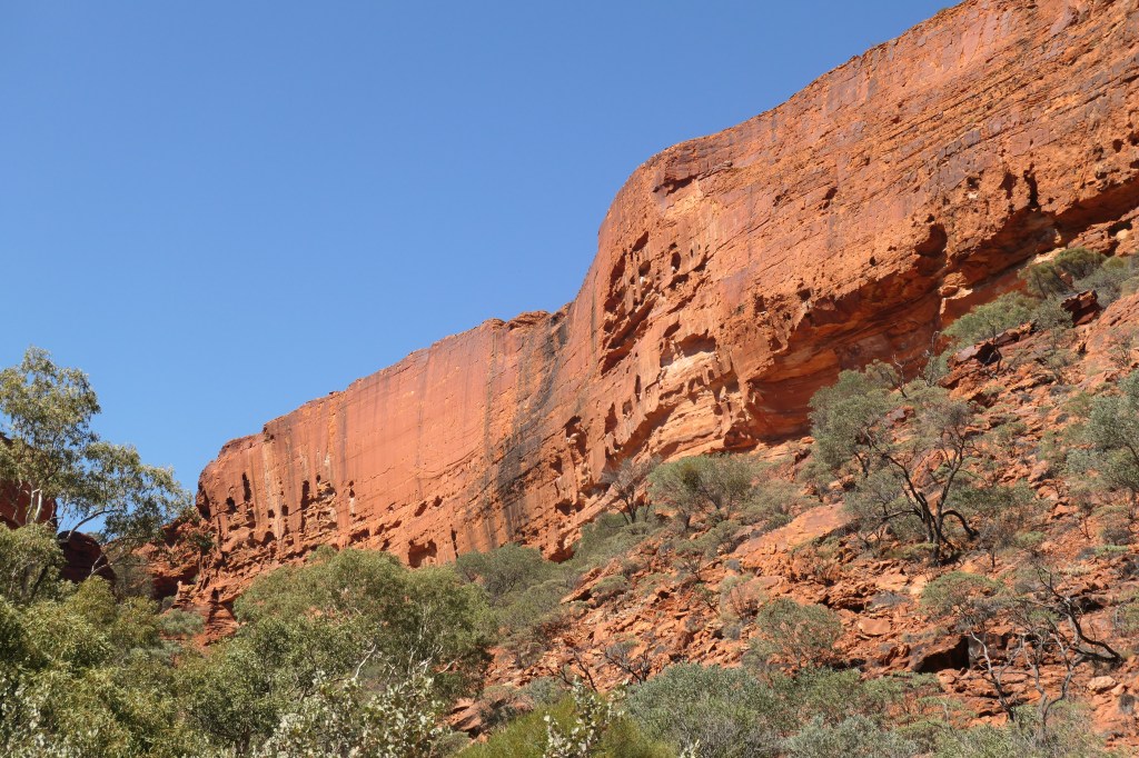
Walking down the canyon base tends to put the canyon into perspective. Its just awesome. I must confess here that I do think Uluru and Katajuta are beautiful, but inevitably prompt people to visit the mighty Kings Canyon.
Ok so its time for home and that 1500kms back to Adelaide. Distance is a thing in Australia… But next year we will be travelling even further as the plan is to head across the Tanami desert track to Western Australia (WA) and the Hamersley’s and then later in the year across the Nullarbor plains to the South of WA. Both vast distances again…but that’s fun! Oh I should mention that we each paid about $2000 for this trip and most of that was fuel as you would imagine.
